|
|
|
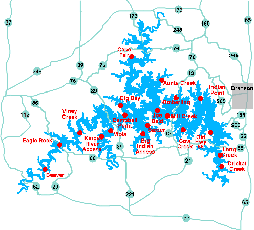
Table Rock Lake
U. S. Army Corps of Engineers started construction of Table Rock Lake in October 1954 and completed in August 1958, while
construction of the powerhouse and switchyard was completed in June 1959. Commercial generation was begun in June 1959. Table Rock Lake has a surface area of approximately 43,100 surface acres, 745 miles of shoreline, and a lake elevation above mean sea level of 915 feet at the top of the Conservation Pool.
On the average the lake will be at or below the figures used for the Conservation Pool because that is what is used as the guide level for the generation of hydroelectric power. It has a maximum height above the river bed of 252 feet and has 10 Spillway Crest Gates.
Campsites are plentiful, with 17 Corps of Engineers public-use areas, national forest lands and a state park.
Boaters have 19 marinas, and there are 125 motels and
resorts with direct access to the water. Lodging and attractions are found at Branson, Kimberling City, Shell Knob, Lampe, Lakeview and Indian Point.
In August 1998 edition of Sail magazine there is a 3 page report about Table Rock Lake.
|
|

